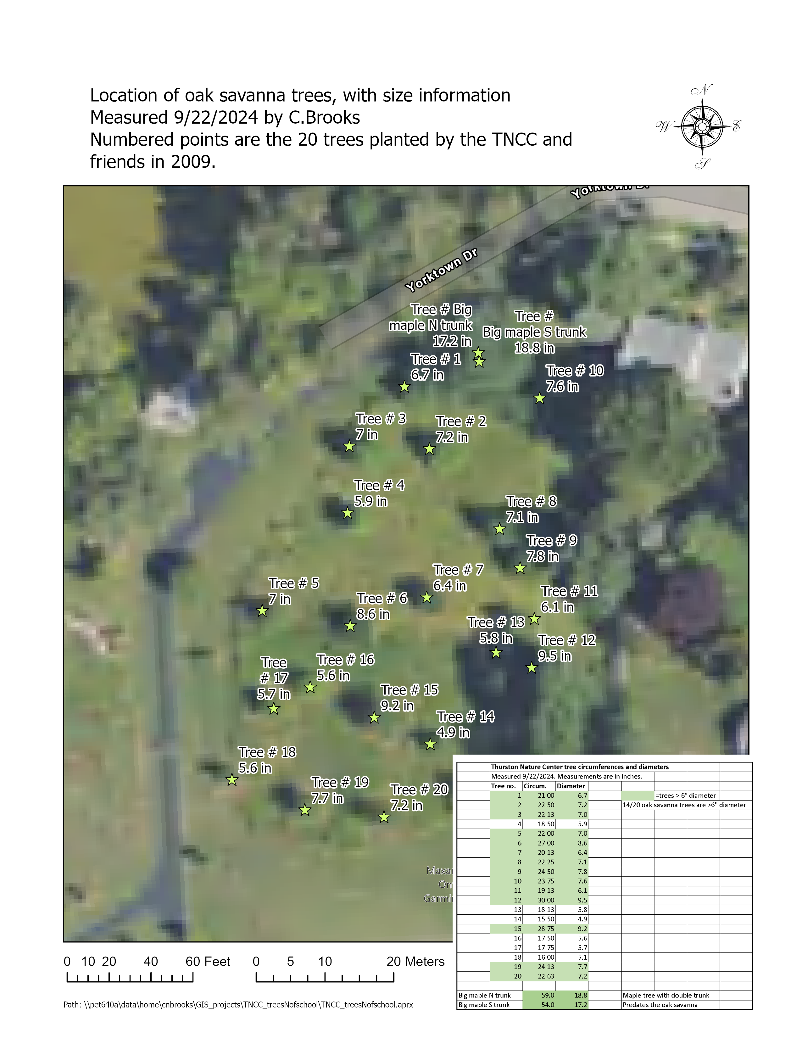
Download a self-guided walking tour map
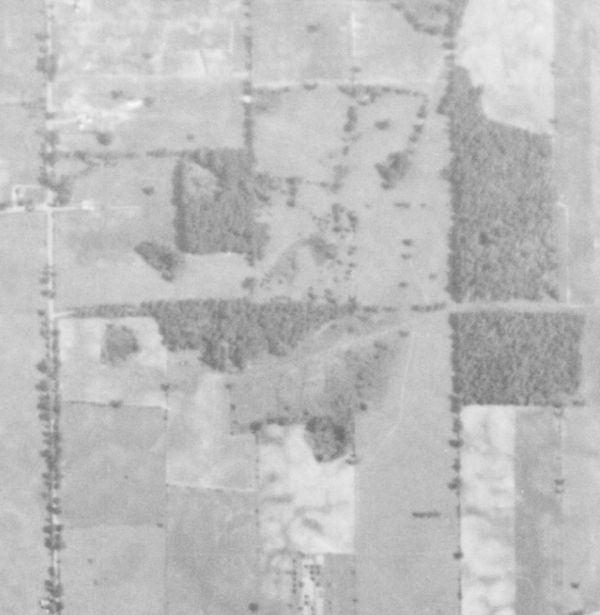
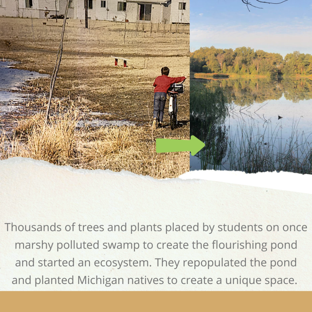
Historical Ariels (dark area indicates marshy swamp area pre-pond creation)
https://thurstonnaturecenter.info/wp-content/uploads/2024/12/TNCC-1955-to-2005-aerial-photos.pdf
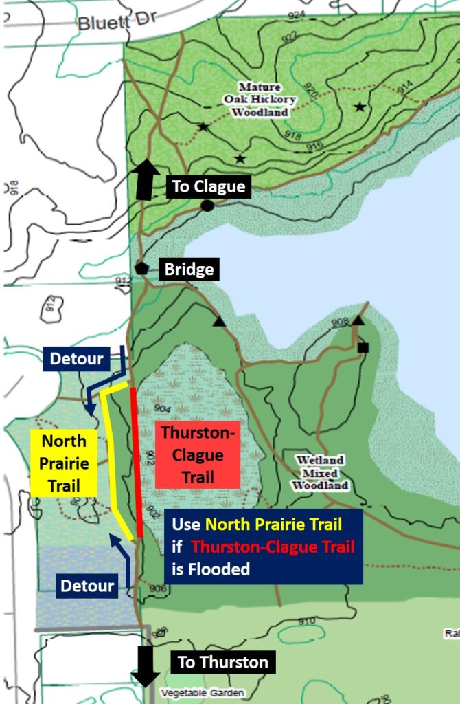
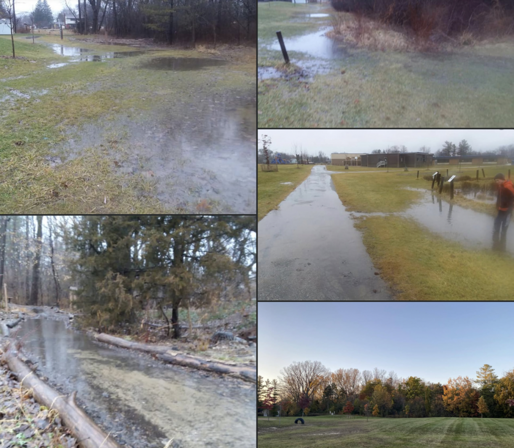
Flooded Trail Detour: The Thurston-Clague Trail is sometimes flooded along the portion shown below in red. A short detour is along the North Prairie Trail. Spring 2022